
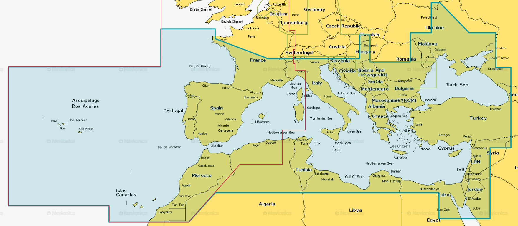
VEU723L-Southern Europe
Garmin BlueChart g3 Vision Karten tagesaktuell... Als Garmin BlueChart Outlet fertigen wir Bestellungen für Seekarten tagesaktuell an. Das bedeutet Sie kaufen jetzt eine Seekarte und wir nutzen - spätestens am folgenden Werktag - einen leeren Blank (microSD/SD) Karte und erstellen Ihnen mit dem Garmin BlueChart Outlet Programmer die entsprechende Seekarte. Sofern es zum Zeitpunkt der Anforderung zum Erstellen dieser Seekarte eine Aktualisierung der Garmin Seekarte gibt, weist das Programm auf die Notwenigkeit zum Download hin. Die Seekarte kann dahingehend erst nach dem Download der letzten offiziellen Version erfolgen. Wir liefern Ihnen BlueCharts jeweils Up-to-Date Details: Informationen Produktcode VEU723L Name Southern Europe Typ Garmin BlueChart g3 Vision Abdeckung Mittelmeer & Schwarzes Meer, Teile des Atlantiks inkl. Kanaren Kompatibilität siehe Reiter Kompatible Plotter. Produktbild grün eingefärbter Bereich Kartenupdate Hier klicken

VUS001R-North Maine
Details: Informationen Produktcode VUS001R Name North Maine Typ Garmin BlueChart g3 Vision Abdeckung From Calais to Camden, including Bar Harbor and Penobscot Bay Kompatibilität siehe Reiter Kompatible Plotter Kartenupdate Hier klicken

VUS002R-South Maine
Details: Informationen Produktcode VUS002R Name South Maine Typ Garmin BlueChart g3 Vision Abdeckung Penobscot Bay through Gloucester, including Casco Bay and Cape Ann Kompatibilität siehe Reiter Kompatible Plotter Kartenupdate Hier klicken

VUS003R-Cape Cod
Details: Informationen Produktcode VUS003R Name Cape Cod Typ Garmin BlueChart g3 Vision Abdeckung Gloucester through New London, including Narragansett Bay, Block Island, Martha's Vineyard, Nantucket Island, the entire Cape, and includes general coverage Georges Bank Kompatibilität siehe Reiter Kompatible Plotter Kartenupdate Hier klicken

VUS004R-New York
Details: Informationen Produktcode VUS004R Name New York Typ Garmin BlueChart g3 Vision Abdeckung Providence to New York, includes Narragansett Bay, all of Long Island, the entire Hudson River, New York Harbor through Perth Amboy and Brick Township Kompatibilität siehe Reiter Kompatible Plotter Kartenupdate Hier klicken

VUS007R-Norfolk-Charleston
Details: Informationen Produktcode VUS007R Name Norfolk-Charleston Typ Garmin BlueChart g3 Vision Abdeckung Newport News, VA to Charleston, SC including Pamlico Sound, Cape Lookout, and Cape Romain Kompatibilität siehe Reiter Kompatible Plotter Kartenupdate Hier klicken

VUS010R-Southeast Florida and Bahamas
Details: Informationen Produktcode VUS010R Name Southeast Florida Typ Garmin BlueChart g3 Vision Abdeckung FEATURING DATA FROM EXPLORER CHARTS FOR THE BAHAMAS!!! Vero Beach south to include Lake Okeechobee, Florida Keys, Dry Tortugas, and covering the west coast of Florida north to Naples. Also covered all the Bahamas, Andros Island, Eleuthera Island, Cat Island, Great Exuma Island, Little Exuma Island, and Hog Cay. Kompatibilität siehe Reiter Kompatible Plotter Kartenupdate Hier klicken

VUS029R-Southern Bahamas
Details: Informationen Produktcode VUS029R Name Southern Bahamas Typ Garmin BlueChart g3 Vision Abdeckung Featuring data from Explorer Charts for the Bahamas Features detailed coverage from Eleuthera Island, Bahamas, to the Dominican Republic, including the Bahamian islands of Great Exuma, Great Inagua, Mayaguana, and many others. Also includes detailed coverage of the Jamaican, Haitian, and Dominican coasts in their entirety, the easternmost quarter of Cuba, and the Turks and Caicos Islands. Kompatibilität siehe Reiter Kompatible Plotter Kartenupdate Hier klicken